The journey north continued along very straight roads through flat country. The altitude began to rise slowly from 50 metres at CP to 450 metres by the NT border. We had spent a night in a roadside camp and now we were heading for the Uluru area. By now fuel prices were rising rapidly and at the NT border we reached $1.95 / litre. In fact by the end of that day we had reached Clifton Springs where the bowser read $2.15 / litre for Distillate.
 |
| Wild Budgies & Finches at the NT border |
 |
| In great numbers |
The traffic was light but the vast majority of vehicles were towing caravans. It is peak tourist season for this area. For the first time in weeks we have a day with clear blue skies. The temperature began at near zero and by mid day it was 15 degrees.
The roadhouses along the highway are marked as towns but no more than a small community built around the service station which almost always houses a bar and cafe / restaurant. They appear to depend totally on passing trade.
Having turned off the Stuart Highway on to the Lassiter highway we encountered a roadhouse with a slight difference. Firstly the fuel bowsers were out of service – service station not selling fuel. Then there was no bar. The grounds were immaculate and the restaurant very neat. This was run by an Indigenous community. Unfortunately the facility was not as busy as others we had encountered.
Next we arrived at our intended destination – a similar roadhouse type facility situated within a cattle station. It is very busy most probably because it is better situated in proximity to the Uluru area but not nearly as professional. Who could learn here?
Our stay at Curtin Springs (85 klms from Uluru) was indeed a real bush camp experience. Curtin Springs is a working cattle station on the Lassiter Highway and it has set up a roadhouse as extra income. At the prices they charge I am sure that cattle have become just a sideline.
 |
Mt Connor within Curtin Springs Station
|
 |
| A large salt lake within cattle station. It is many klms long. Note the island in centre. |
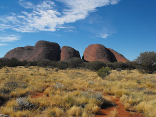
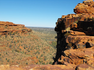
From here we travelled to Uluru (Ayres Rock) Kata Tjuta (The Olgas) and also Kings Canyon. These are marvellous examples of creation and words do not express or pictures adequately represent the grandeur of these geological features. Therefore we will just let the pictures attempt to give a glimpse.
 |
Kata Tjuta (The Olgas)
|
 |
| The Olgas |
 |
| The Valley of the winds - Kata Tjuta |
 |
| A gorge in KataTjuta |
 |
Uluru in late afternoon
|
 |
| Uluru up close |
 |
| Kings Canyon |
 |
| A high wall of the canyon |
 |
| Beautiful gums on floor of canyon |
 |
| Taken from the rim of canyon |
 |
| Brilliant rock formations on canyon rim |


No comments:
Post a Comment
Note: Only a member of this blog may post a comment.